
Disputed territory · Himalayas
Arunachal Pradesh
Tense: rival maps, place names and patrolsUpdated October 12, 2026
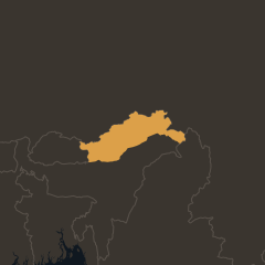
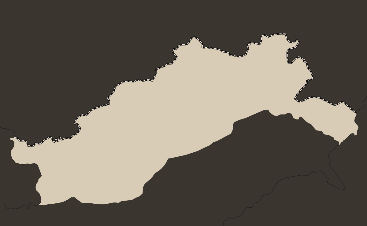
Arunachal Pradesh is India's northeasternmost state, 83,743 km² of mountains and forest bordering Bhutan, China and Myanmar, and China claims most or all of it. India says its border with China there follows the McMahon Line, agreed between British India and Tibet in 1914. China rejects that line, which it says its government never accepted, and calls the area Zangnan, or South Tibet. Chinese troops crossed into the area in the 1962 war and then withdrew. Since 2017 China has published six lists of Chinese names for places in the state, which India rejects.
- Area
- 83,743 km²
- India's northeasternmost state
- People
- 1.38 million
- India's 2011 census
- McMahon Line
- 1914
- treated by India as the border, rejected by China
- Chinese place names
- 112
- in six lists since 2017, rejected by India
Arunachal Pradesh in 30 seconds
- India governs Arunachal Pradesh, a state of 1.38 million people at India's 2011 census. China claims most or all of it.
- India says its border follows the McMahon Line, agreed by British India and Tibet in 1914. China rejects the line, saying its government never accepted it.
- In the 1962 war, which India calls Chinese aggression and China a counterattack, Chinese troops took Tawang and advanced toward the plains of Assam. China then withdrew north of the McMahon Line.
- China has published 112 Chinese names for places in the state since 2017, including 23 in April 2026. India rejects them and published its own standard names for 27 places in August 2026.
Who controls Arunachal Pradesh?
India governs Arunachal Pradesh as one of its states, and China claims most or all of it. From 1954 to 1972 the area was the North-East Frontier Agency (NEFA). It became a union territory on January 21, 1972 and a state on February 20, 1987. India's 2011 census counted 1,383,727 people, about 12% of them Buddhist. The state has more than 20 major tribes (26, by the state government's count). Pema Khandu has been chief minister since July 2016. He first led a Congress government, then joined the BJP, Prime Minister Narendra Modi's party, in December 2016, and was sworn in for a third term on June 13, 2024.
China's foreign ministry calls the area Zangnan and says China does not recognize the state, which it says India "illegally set up." India's government puts China's claim in the eastern sector of the border at about 90,000 km², more than the state's official area. China has not published a figure.
Each side in its own words
 IndiaArunachal Pradesh "was, is, and will always remain an integral and inalienable part of India" (Randhir Jaiswal, foreign ministry, May 2025)
 China"Zangnan region is China's territory. China does not recognize the so-called 'Arunachal Pradesh' illegally set up by India" (Guo Jiakun, foreign ministry, April 2026)
 ARUNACHAL
PRADESH CHINA INDIA BHUTAN MYANMAR McMahon Line Tawang Se La Bomdila Itanagar Pasighat Walong Tezpur Medog Nyingchi
 ARUNACHAL
PRADESH CHINA INDIA McMahon Line Tawang Bomdila Itanagar Pasighat Medog Nyingchi
What is the McMahon Line?
The McMahon Line is a line between British India and Tibet, agreed alongside the Simla conference of 1913-14. India treats it as its border with China, and China rejects it. Henry McMahon, for British India, and Lonchen Shatra, for Tibet, agreed on it in an exchange of notes on March 24-25, 1914. Ivan Chen, China's delegate, initialed a draft of the Simla convention on April 27, 1914. India says the map he initialed showed the line. China says he initialed only on condition that his government approved, which it did not. Only Britain and Tibet signed the final text, on July 3, 1914.
India says the line follows the crest of the Himalayan watershed, the area's traditional boundary, and that Tibet was free to agree to it. China says the line was a product of British policy, that Tibet, as part of China, could not agree to it alone, and that Tibet still ran Tawang until 1951. Zhou Enlai first called the line illegal in letters to Nehru in 1959. On February 9, 1951 Ralengnao "Bob" Khathing, an Indian official who had reached Tawang with a small escort of Assam Rifles, declared it under Indian administration.
How the border took shape
- 1914British India and Tibet agree on the McMahon Line. China does not sign the Simla convention
- 1951An Indian official takes over the running of Tawang
- 1959Zhou Enlai tells Nehru China considers the line illegal. The Dalai Lama crosses into India
- 1962Chinese troops take Tawang, then withdraw north of the line
- 1987Arunachal Pradesh becomes a state, during a face-off at Sumdorong Chu
- 2017China publishes its first list of Chinese names for places in the state
- 2022Indian and Chinese soldiers clash at Yangtse, near Tawang
- 2026China issues 23 more names, and India publishes its own
What happened in the 1962 war and since?
On October 20, 1962 Chinese troops attacked Indian posts on the Namka Chu, a river near the western end of the McMahon Line, where the two sides disagreed on exactly where the line ran. India calls the war Chinese aggression. China calls it a "self-defense counterattack" against Indian advances. Chinese troops took Tawang in late October and in November advanced through the Se La pass and Bomdila toward the plains of Assam. China announced a unilateral ceasefire on November 21, 1962, and from December 1 it withdrew to 20 km behind the line each side held on November 7, 1959, which in the east means north of the McMahon Line.
The two armies faced off again at Sumdorong Chu, near Tawang, in 1986-87. On December 9, 2022 Indian and Chinese soldiers clashed at Yangtse, near Tawang. India's defense minister said Chinese troops tried to "unilaterally change the status quo" and that India had no deaths or serious injuries. China's army said Indian troops "illegally crossed" the line and blocked a routine Chinese patrol. In July 2026 local media reported patrols face to face near Taksing, and on September 6-7 the two armies held their first talks between corps commanders on this part of the border.
Face-offs since 1962
- Sumdorong Chu, 1986-87India protests a Chinese post at Wangdung and airlifts troops into the area. The face-off lasts months
- Yangtse, December 2022India reports minor injuries on both sides, and each side blames the other
- Taksing, July-August 2026Local media report patrols face to face. A local party allied with the BJP alleges Chinese encroachment. India's army calls the reports "incorrect", and China says the border is "generally stable"
What are China's names for places in Arunachal Pradesh?
Since 2017 China's Ministry of Civil Affairs has published six lists of what it calls "standard names" for places in the state, 112 in all, and India rejects every one. The most recent list, on April 10, 2026, had 23 names. China says the names follow from its position that "Zangnan region is China's territory." India's foreign ministry said in May 2025 that "creative naming will not alter the undeniable reality." In April 2026 India rejected "mischievous attempts" to assign "fictitious names."
On August 7, 2026 India published its own standard names for 27 places on a Survey of India map, including mountain passes, a high-altitude lake and Longju, a border village where Chinese troops overran an Indian post in 1959. China's foreign ministry called the move "illegal, null and void."
Chinese names for places in the state, by list
Why does Tawang matter?
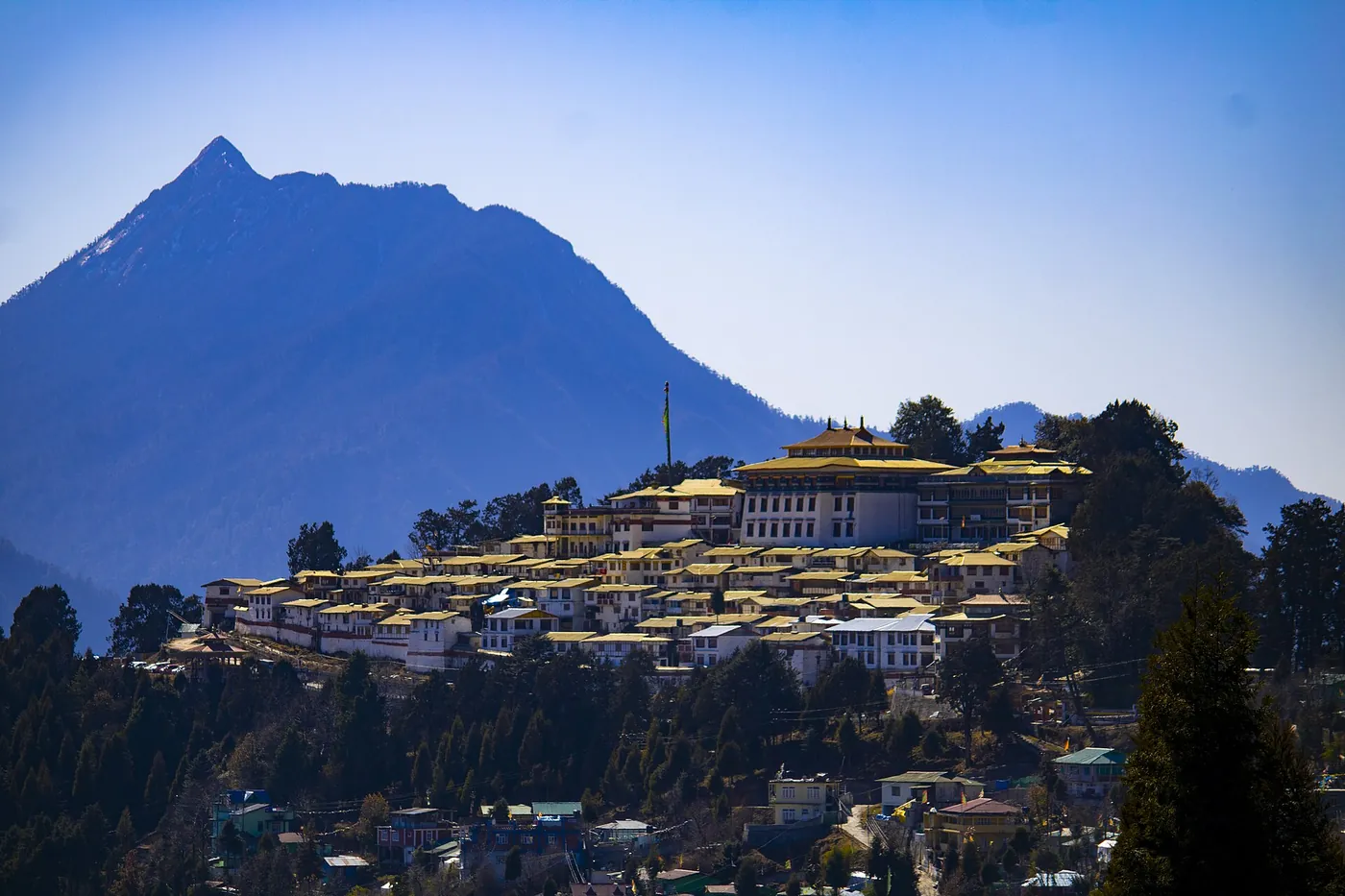
Tawang, in the west of the state, is a center of Tibetan Buddhism. According to the Lowy Institute, an Australian research group, China's claim began with Tawang and later grew to the whole state. Tawang Monastery was founded in 1680-81 at the wish of the 5th Dalai Lama, and the 6th Dalai Lama, Tsangyang Gyatso, was born nearby in 1683. The 14th Dalai Lama crossed into India at Khenzimane, riding a yak, on March 31, 1959, after fleeing Tibet, and passed through Tawang.
In March 2025 the Dalai Lama wrote that his successor would be born in the "free world." On July 2, 2025 he said the institution of the Dalai Lama "will continue" after his death and that only his office, the Gaden Phodrang Trust, can recognize his successor. China's foreign ministry said the successor must be found by a search in China, chosen by drawing lots from a golden urn and approved by China's central government. Because the 6th Dalai Lama was born near Tawang, a successor from India's Tibetan Buddhist areas would have a precedent. India's foreign ministry said the government takes no position on matters of faith.
The poet Dalai Lama
1683
The 6th Dalai Lama is born near Tawang
About 65 short love songs, in four-line Tibetan folk verse, are credited to Tsangyang Gyatso. He refused full monastic vows. Scholars still debate who wrote the songs and whether he died in 1706.
What is at stake in Arunachal Pradesh?
Water
On July 19, 2025 China began building a hydropower project on the Yarlung Tsangpo near the border, at a cost China puts at about 1.2 trillion yuan. The river flows into India as the Siang and then the Brahmaputra. India says it is monitoring the project. China says it will not harm countries downstream.
Roads and villages
India opened the Sela tunnel near Tawang in March 2024. China has built "xiaokang" (moderately prosperous) villages on its side of the Line of Actual Control (LAC), the line each army actually holds. One, in Upper Subansiri district, sits on land India claims and that, according to Indian defense sources, China has controlled since 1959.
A dam India plans
India plans its own dam on the Siang, of about 11,000 MW, which Indian officials say would store water and guard against sudden releases from upstream. Many people of the Adi, a local tribe, oppose it. On September 30, 2026 protesters vandalized a state legislator's house, and villagers accused police of beating people at Uggeng on October 4.
Questions about Arunachal Pradesh
Is Arunachal Pradesh part of India or China?
India governs Arunachal Pradesh as one of its states. China claims most or all of it and does not recognize the state. India and China have never agreed on a boundary there between them, and it has never been marked on the ground. Boundary negotiators last met in August 2026, and Narendra Modi and Xi Jinping backed seeking a "fair, reasonable and mutually acceptable" boundary settlement on September 12, 2026.
What does Zangnan mean?
Zangnan means "South Tibet" in Chinese. China's Ministry of Civil Affairs has used the name in its place-name lists since 2017. China's government now also writes "southern part of Xizang," its name for Tibet. Arunachal Pradesh is Sanskrit for "land of the dawn-lit mountains."
What are stapled visas?
A stapled visa is a visa on a loose sheet stapled into the passport instead of stamped on a page. China has at times issued them to Indians from Arunachal Pradesh, which China says is Chinese territory. In July 2023 three Indian wushu athletes received them, and India pulled its wushu team from the World University Games in Chengdu. In November 2025 Pema Wangjom Thongdok, an Indian born in the state, said she was held for about 18 hours while changing planes at Shanghai airport because, she said, officials called her passport invalid since she was born in Arunachal Pradesh. India protested, and China denied detaining her.
Where does India see its first sunrise?
In Dong, a hamlet about 1,240 m up in Anjaw district, near the borders with China and Myanmar. Dong is said to get India's first sunrise. In 2025 Chief Minister Pema Khandu launched a yearly Sun Rise Festival there, running from December 29 to January 2.