
Disputed territory · Southeast Asia
South China Sea
Tense: a Philippine supply run was blocked in SeptemberUpdated October 12, 2026
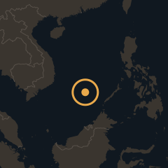
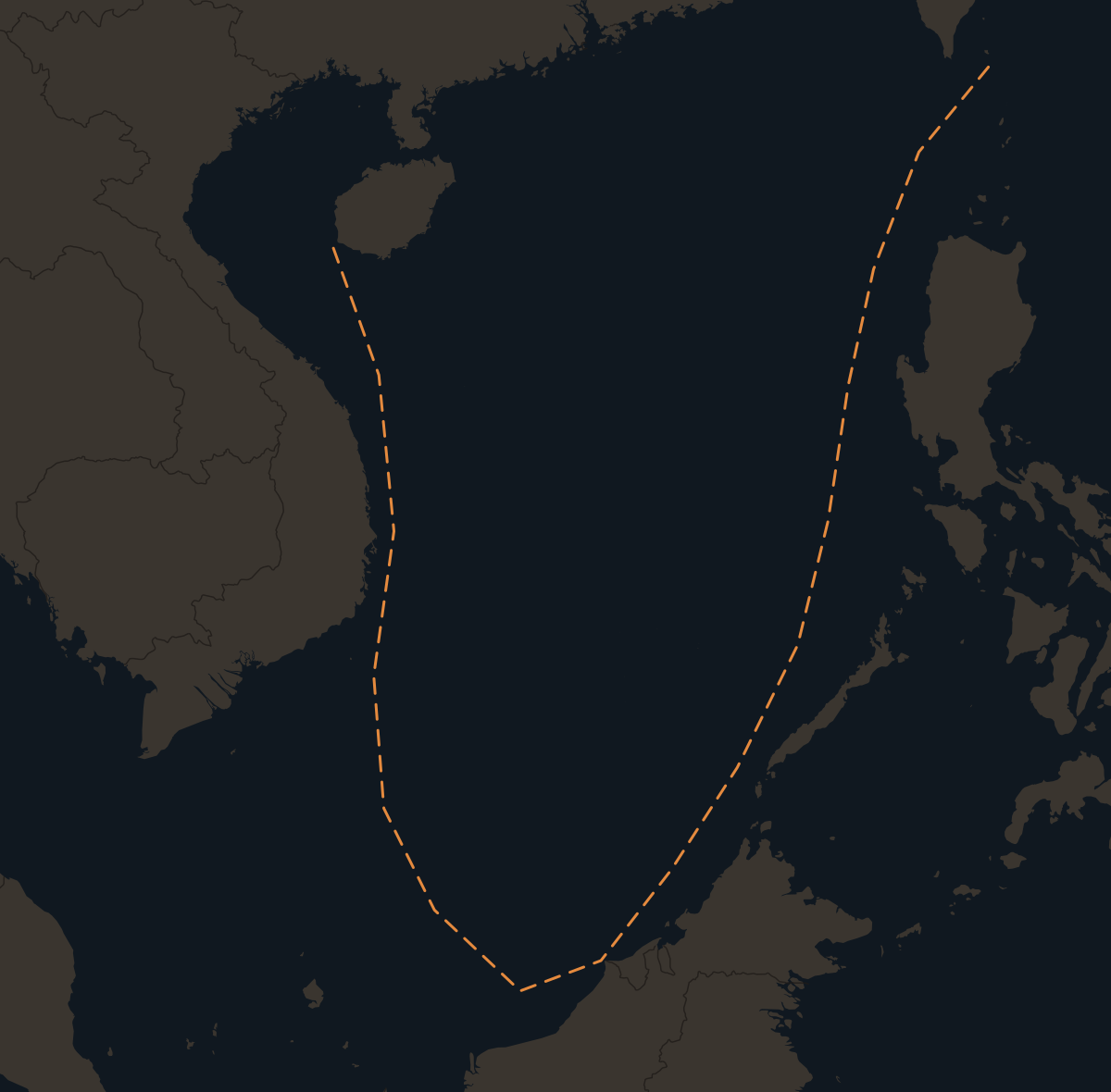
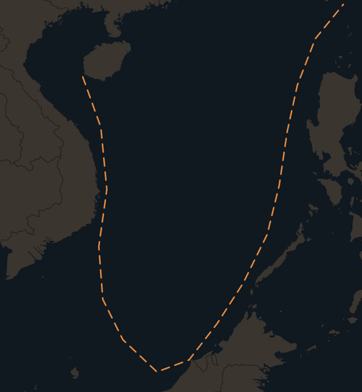
Six governments dispute the South China Sea: China, Taiwan, Vietnam, the Philippines, Malaysia and Brunei. They claim overlapping rights to small islands, reefs and the waters around them. China claims most of the sea inside a dashed line on its maps, known as the nine-dash line. Five governments occupy islands or reefs in the Spratlys. China has held all the Paracels since 1974. On September 24, 2026, Chinese ships blocked a Philippine supply run to Second Thomas Shoal, the first since 2024.
- Claimants
- 6
- China, Taiwan, Vietnam, the Philippines, Malaysia, Brunei
- Trade through it
- $3.4 trillion
- in 2016, about 21% of world trade (CSIS)
- Land China built
- 13 km²
- in the Spratlys, 2013-16
- Tribunal ruling
- 2016
- no legal basis for China's historic rights
South China Sea in 30 seconds
- China claims most of the sea inside a dashed line first published on a 1947 map. Taiwan claims the same area.
- In the Spratlys, Vietnam holds 21 features, the Philippines 9, China 7, Malaysia 5 and Taiwan 1. China holds all the Paracels and Scarborough Shoal.
- China built artificial islands with runways in the Spratlys from 2013 to 2016. Vietnam has since built almost as much land.
- A 2016 tribunal ruled that China has no legal basis for historic rights inside the line. China calls the ruling null and void. Most recent clashes are between Chinese and Philippine ships.
Who claims the South China Sea?
China's claim follows a dashed line first published in December 1947 on a map by the Republic of China, the government that moved to Taiwan in 1949. The line had eleven dashes. In the early 1950s the People's Republic of China dropped the two in the Gulf of Tonkin, leaving nine. China's standard map of August 28, 2023 showed ten dashes. The tenth is east of Taiwan. Taiwan's claim covers the same area, using the original eleven-dash line. Vietnam claims both the Paracel Islands and the Spratly Islands. The Philippines claims part of the Spratlys, Scarborough Shoal and its exclusive economic zone, the belt of sea 200 nautical miles from its coast where it controls fishing, oil and gas. The Philippines has called its waters the West Philippine Sea since 2012.
Malaysia and Brunei claim zones off Borneo. Brunei holds no features. Indonesia is not a claimant. China's line overlaps Indonesia's zone near the Natuna Islands. Indonesia renamed those waters the North Natuna Sea in 2017. Vietnam calls the whole sea the East Sea.
The six claimants
 ChinaClaims most of the sea inside the dashed line
 TaiwanThe same area. Holds Itu Aba, the largest natural Spratly island.
 VietnamThe Paracels and the Spratlys. Holds the most Spratly features.
 PhilippinesPart of the Spratlys, Scarborough Shoal and its 200-mile zone
 MalaysiaThe southern Spratlys off Borneo
 BruneiA zone off its coast. Holds no islands.
 CHINA
VIETNAM
PHILIPPINES
MALAYSIA
TAIWAN
South China Sea
Paracel Islands
Spratly Islands
Woody Island
Scarborough Shoal
Thitu
Subi Reef
Itu Aba
Mischief Reef
Second Thomas Shoal
Fiery Cross Reef
Spratly Island
Swallow Reef
Natuna Islands
CHINA
VIETNAM
PHILIPPINES
MALAYSIA
TAIWAN
South China Sea
Paracel Islands
Spratly Islands
Woody Island
Scarborough Shoal
Thitu
Subi Reef
Itu Aba
Mischief Reef
Second Thomas Shoal
Fiery Cross Reef
Spratly Island
Swallow Reef
Natuna Islands
 CHINA
VIETNAM
PHILIPPINES
South China Sea
Paracel Islands
Spratly Islands
Woody Island
Scarborough
Thitu
Second Thomas
Fiery Cross Reef
Spratly Island
Swallow Reef
CHINA
VIETNAM
PHILIPPINES
South China Sea
Paracel Islands
Spratly Islands
Woody Island
Scarborough
Thitu
Second Thomas
Fiery Cross Reef
Spratly Island
Swallow Reef
Who controls the islands?
In the Spratlys, Vietnam holds 21 features, the Philippines 9, China 7, Malaysia 5 and Taiwan 1, according to CSIS AMTI as of August 2025. Other sources count Vietnam's features differently. The natural islands are tiny. Itu Aba, held by Taiwan, is the largest and measures under 0.5 km².
China has held all the Paracel Islands since 1974. China already held the eastern Amphitrite group. China took the western Crescent group from South Vietnam in a battle on January 19-20, 1974. About 74 South Vietnamese were killed. China reported 18 dead. Woody Island is the seat of China's Sansha city. Vietnam says 64 Vietnamese were killed in a clash with China at Johnson South Reef, in the Spratlys, on March 14, 1988. China has controlled Scarborough Shoal with coast guard ships, not permanent structures, since a 2012 standoff with the Philippines. On September 10, 2025, China declared a nature reserve there. The Philippines protested.
Spratly features each country occupies
- Vietnam21
- Philippines9
- China7
- Malaysia5
- Taiwan1
Why does China build islands in the South China Sea?
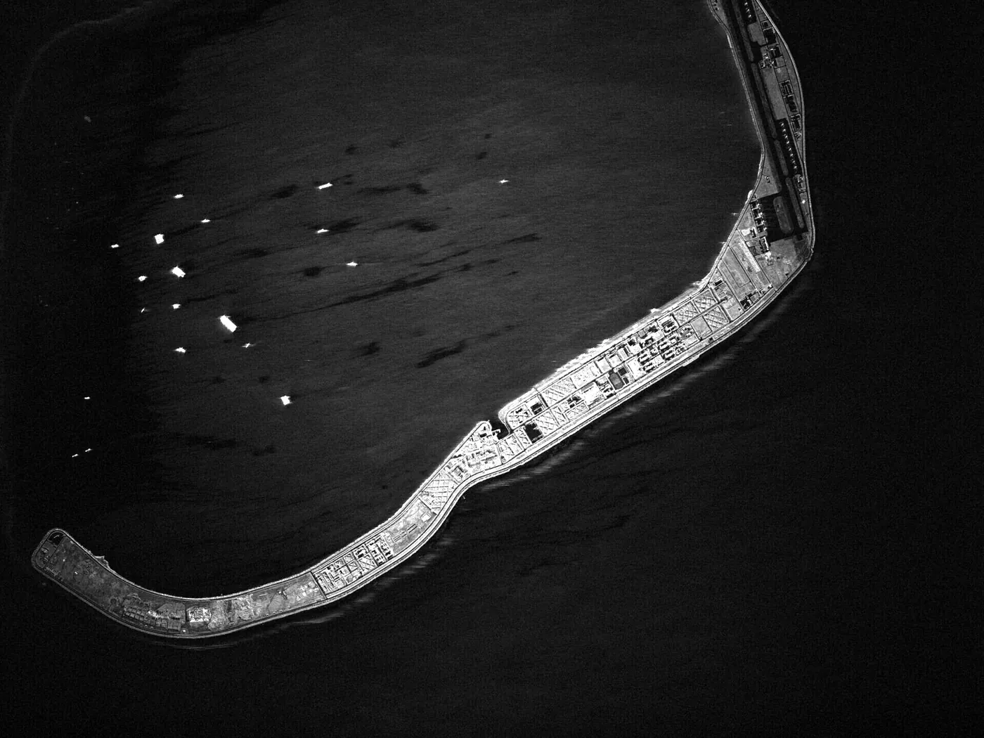
From 2013 to 2016, China turned seven reefs in the Spratlys into artificial islands totaling about 3,200 acres (13 km²). China built runways on Fiery Cross Reef, Subi Reef and Mischief Reef, along with harbors and radar. China says the islands serve civilian uses such as search and rescue and weather forecasting, as well as defense. They also let Chinese ships and planes stay in the area all year.
Vietnam has since built about 2,771 acres (11.2 km²) in the Spratlys, including 534 acres in the year to May 2026. Vietnam has not overtaken China. In the Paracels, China built a new island at Antelope Reef starting in October 2025. By March 2026 the island covered about 1,490 acres (6 km²), and CSIS AMTI reported the work complete on August 14, 2026. AMTI says it is likely now the largest island in the South China Sea. In late August Vietnam called the work illegal and demanded a halt. Counting its work in the Paracels, China's total artificial land is about 5,460 acres (22 km²).
Artificial land built in the Spratlys
- China13 km²
- Vietnam11.2 km²
What did the 2016 ruling say?
In 2013, the Philippines brought a case against China before an arbitral tribunal under the UN Convention on the Law of the Sea. On July 12, 2016, the tribunal ruled that China has no legal basis to claim historic rights to resources inside the dashed line. The tribunal also found that no Spratly feature generates a 200-mile exclusive economic zone, not even Itu Aba. It ruled that Mischief Reef and Second Thomas Shoal are low-tide elevations, reefs that are underwater at high tide, inside the Philippines' exclusive economic zone. The tribunal did not rule on who owns the islands.
China called the award "null and void and has no binding force." On July 11-12, 2026, the award's 10th anniversary, 14 countries including the United States, Japan and the United Kingdom called it final and legally binding.
What the tribunal found
- Historic rightsChina has no legal basis for historic rights to resources inside the dashed line
- Islands and rocksNo Spratly feature earns a 200-mile zone, not even Itu Aba
- Mischief ReefA low-tide elevation within the Philippines' exclusive economic zone
- SovereigntyNot decided. The tribunal could not rule on who owns the islands.
What happens at Second Thomas Shoal?
Philippine Marines live aboard the BRP Sierra Madre, a rusting ship grounded deliberately on Second Thomas Shoal in May 1999. China's coast guard surrounds it. On June 17, 2024, Chinese coast guard personnel with an axe and knives rammed and boarded Philippine Navy supply boats. China said it acted lawfully. Seaman First Class Jeffrey Facundo lost his right thumb. Surgeons rebuilt it in November 2024 using bone from his rib. President Marcos had awarded Facundo the Order of Lapu-Lapu in June 2024.
On July 21, 2024 the Philippines and China agreed a provisional arrangement for supply runs. China now says the runs need its approval, which the Philippines denies. On July 20, 2026, a Chinese coast guardsman struck a Philippine sailor with a baton at the shoal. On the night of September 24, 2026, Chinese warships and coast guard cutters blocked a resupply run about 60 nautical miles from the shoal. The Philippines called off the mission. It was the first resupply mission blocked since 2024.
The United States says its 1951 Mutual Defense Treaty with the Philippines covers armed attacks on Philippine forces, public ships and aircraft, including the coast guard, anywhere in the South China Sea.
BRP Sierra Madre
Built 1944
One ship, three navies
Built as USS LST-821 in 1944, the ship fought at Okinawa for the US Navy in 1945. Renamed USS Harnett County, she served as a floating base for helicopter gunships in Vietnam's Mekong Delta. She became South Vietnam's RVNS My Tho in 1970. She escaped to the Philippines with the South Vietnamese fleet in 1975 and joined the Philippine Navy as BRP Sierra Madre in 1976. She has sat rusting on Second Thomas Shoal since 1999.
Why does the South China Sea matter?
Trade
About $3.4 trillion of goods passed through the South China Sea in 2016, roughly 21% of world trade. The sea connects the Strait of Malacca to the ports of China, Japan and South Korea.
Fish
An estimated 12% of the world's fish catch came from the South China Sea in 2015. The catch feeds millions in the countries around the sea. Many recent clashes involve Philippine fisheries patrol ships protecting Filipino fishermen.
Oil and gas
The US Energy Information Administration estimated 11 billion barrels of oil and 190 trillion cubic feet of natural gas in proved and probable reserves in 2013. Much of it lies in undisputed waters near the coasts.
Questions about the South China Sea
What is the nine-dash line?
The nine-dash line is a dashed line China draws on its maps around most of the South China Sea. The Republic of China, the government that moved to Taiwan in 1949, first published it in December 1947 with eleven dashes. In the early 1950s the People's Republic of China dropped the two in the Gulf of Tonkin, leaving nine. China's standard map of August 28, 2023 showed ten dashes. The tenth is east of Taiwan. China has never said exactly what the line means or given its coordinates.
Is the South China Sea international waters?
Most of the South China Sea is either a country's 200-mile exclusive economic zone or high seas. Under the UN Convention on the Law of the Sea, ships of all countries can pass through both. China objects to foreign warships operating near the islands it holds. The United States sails warships through the area to show it disagrees. On August 13, 2025, the USS Higgins sailed near Scarborough Shoal.
What is the West Philippine Sea?
The West Philippine Sea is the Philippines' name for the parts of the South China Sea within its exclusive economic zone. President Aquino signed Administrative Order 29 on September 5, 2012, creating the name. Vietnam calls the sea the East Sea. Indonesia calls its northern Natuna waters the North Natuna Sea.
Would the United States defend the Philippines?
The 1951 Mutual Defense Treaty commits each side to act, in line with its constitutional processes, if the other's armed forces, public ships or aircraft are attacked in the Pacific. Guidelines signed on May 3, 2023 say this includes attacks on either country's coast guard anywhere in the South China Sea. Neither the treaty nor the 2023 guidelines say how serious an attack must be to count.