
Siachen Glacier
The glacier in the Karakoram where India and Pakistan have stationed troops above 20,000 feet since 1984, the world's highest battlefield.
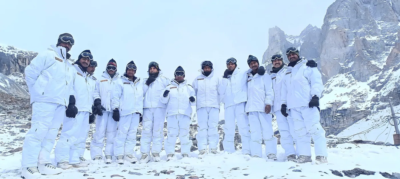
The Siachen Glacier is a 76-kilometer sheet of ice in the eastern Karakoram range, at the northern end of the disputed territory of Kashmir. It is the second-longest glacier outside the polar regions. Since 1984, India and Pakistan have stationed troops on and around it at altitudes above 20,000 feet, making it the world's highest battlefield. Nobody lives there. It has no natural resources, and no road crosses it. Far more soldiers have died there from altitude, weather, and avalanches than from enemy fire. India spends several hundred thousand dollars daily to keep its posts supplied. A ceasefire has held since 2003, but soldiers keep dying from the conditions. After more than forty years, neither country will leave.
How a gap on a map brought armies to the Siachen Glacier
In 1949, after their first war over Kashmir, India and Pakistan drew a ceasefire line through the territory. The surveyors ran the line as far as a map coordinate labeled NJ9842, where the mountains began, and noted only that the line ran north toward the glaciers. They gave no precise course beyond that point. The terrain was 70 kilometers of glacier at altitudes where helicopters can barely hover, and nobody expected anyone to fight over it.
Both countries later read the vague wording differently. During the 1970s, Pakistan began granting climbing permits for peaks on the glacier to foreign expeditions. Published maps started drawing the ceasefire line toward the Karakoram Pass to the northeast, placing the glacier on Pakistan's side of the border. Indian officers took notice. Indian climbers repeatedly encountered foreign teams on the glacier carrying Pakistani permits. Indian intelligence learned that Pakistani officers were purchasing high-altitude cold-weather equipment in Europe.
India acted before Pakistan could. On April 13, 1984, Lieutenant General Prem Nath Hoon led the Indian Army's Operation Meghdoot. Helicopters airlifted troops onto the glacier, and they seized the key passes on the Saltoro Ridge, which controls the western approaches. The operation came just ahead of Pakistan's own planned deployment. Since then, India has held the ridge and the high ground. Pakistan occupies positions at lower elevations to the west but has never gained the heights.
What soldiers face on the Siachen Glacier
Military posts on the glacier reach altitudes of 22,000 feet. At that height, each breath takes in less than half the oxygen available at sea level. Temperatures can drop to minus 50 degrees Celsius, with winds that exceed 100 miles per hour. Soldiers deploy for months at a time, and there is no natural shelter. Every structure has to be built from material flown in or carried up by hand. The lasting damage includes pulmonary edema, cerebral edema, frostbite, and memory loss. Soldiers often lose 10 to 15 kilograms during a single deployment. Everything the troops need, from kerosene to drinking water, has to be flown in by helicopter or carried up by porters.
The most celebrated action on the glacier came in 1987. Pakistani forces held Quaid Post at about 21,000 feet, the highest point in the area. From there they could see across the entire glacier. An Indian patrol on May 29 failed and cost ten soldiers their lives. On June 26, a team led by Naib Subedar Bana Singh climbed through the night and captured the post. Singh received the Param Vir Chakra, India's highest military honor, and the army renamed the post Bana Post.
The worst single disaster came on April 7, 2012, when an avalanche struck the Pakistani Army's 6th Northern Light Infantry headquarters at Gayari, killing 140 people, 129 soldiers and 11 civilians. By 2012, India had recorded 846 soldiers dead on the glacier. Pakistan's losses over the same years exceeded 1,000. On both sides, the vast majority of deaths resulted from avalanches, falls into crevasses, altitude sickness, and exposure, not from combat.
Who controls the Siachen Glacier?
India has controlled the Siachen Glacier since Operation Meghdoot in 1984. Indian troops hold the Saltoro Ridge and the glacier itself. Pakistan occupies lower positions to the west and claims the territory but has made no gains in four decades.
The ceasefire that took hold in late 2003 has survived even serious crises. In May 2025, India and Pakistan traded missiles and drones for four days after an attack killed 26 civilians in Pahalgam, a town in Indian-administered Kashmir. The Saltoro Ridge stayed silent throughout.
Despite the quiet, no agreement to withdraw has been reached. Pakistan wants both sides to pull back to their positions before 1984. India insists that the current positions be marked on a map and signed before anyone moves. India's position hardened after the Kargil War in 1999, when Pakistani soldiers moved onto peaks that Indian forces had withdrawn from during the winter months. That insistence on a signed line has stalled every negotiation for more than thirty years.
The glacier is shrinking and polluted by forty years of military waste, fuel, and equipment left at the posts. It feeds the Nubra River, which flows into the Shyok and then the Indus. The Indus is the river system that Pakistan's agriculture depends on. Both countries still keep thousands of soldiers on and around the glacier, and no talks on withdrawing have succeeded.