
38th Parallel
The 38th parallel is the line of latitude that divided Korea in 1945, chosen by two American officers in thirty minutes.
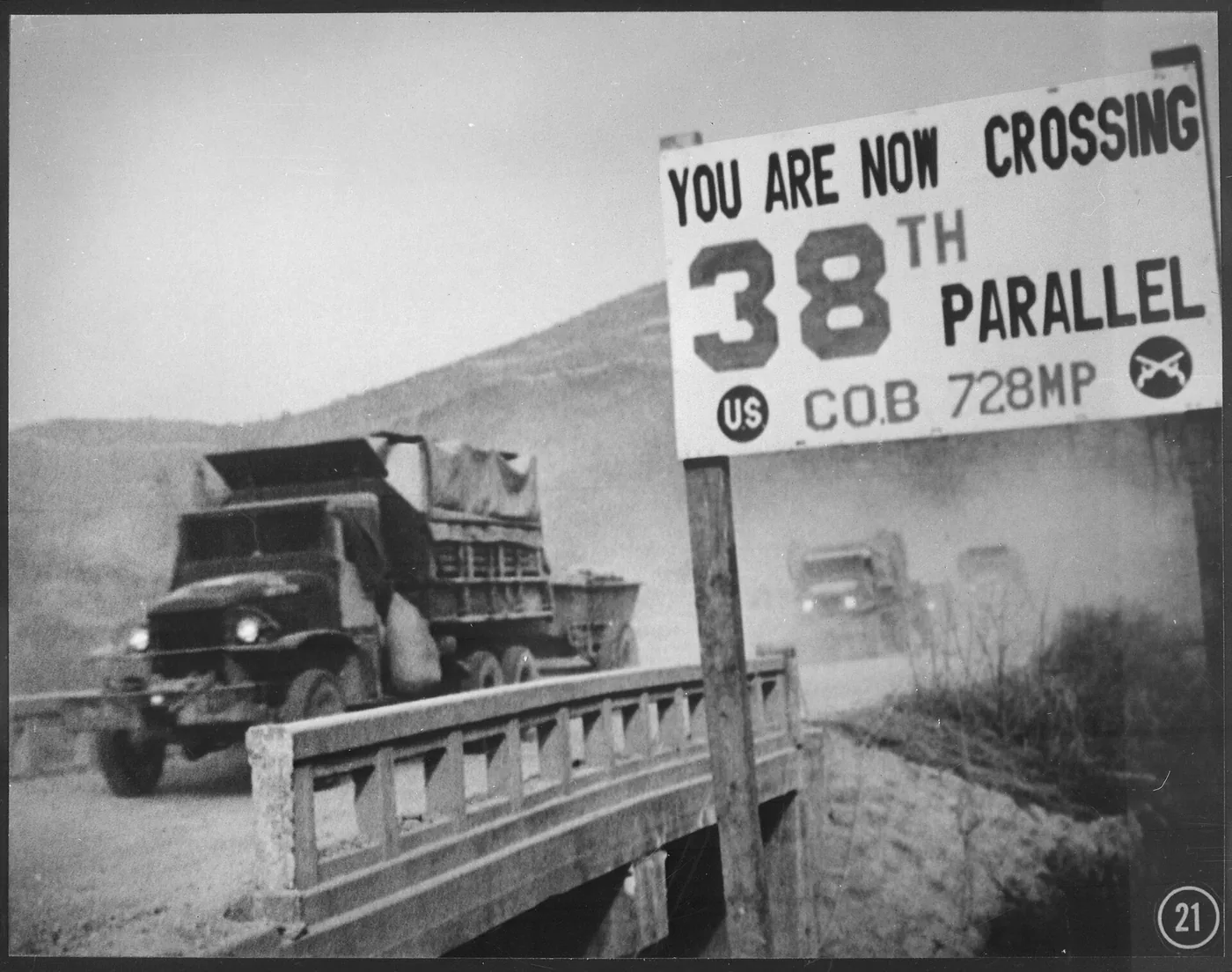
The 38th parallel is the line of latitude that divided Korea into a Soviet occupation zone in the north and an American zone in the south in August 1945, at the end of World War II. Two American colonels chose the line in about thirty minutes, using a National Geographic wall map, because it kept Seoul in the American zone. The division was supposed to be temporary, lasting only until Korea formed a unified government. Instead it produced two hostile states, a war that killed millions of people, and one of the most heavily fortified borders on Earth. South Korea has grown into one of the world's largest economies. North Korea has become one of the most isolated countries on Earth and has built nuclear weapons. More than eighty years later, the division remains.
How two American colonels divided Korea
On the night of August 10, 1945, hours after Japan signaled it would surrender, two colonels at the War Department received an urgent assignment. They had roughly half an hour to decide where to split Korea between a Soviet zone and an American one. The question was which Allied forces would accept the Japanese surrender in each part of the country. Soviet troops were already advancing into northern Korea. The nearest American soldiers were on Okinawa, roughly 600 miles to the south.
The two colonels were Dean Rusk and Charles Bonesteel. Rusk was 36 and had spent much of the war as a staff officer in the China-Burma-India theater. Bonesteel came from a military family. Neither had been to Korea. No Korea experts were consulted, and no Koreans were asked. Their only reference was a National Geographic map hanging on the office wall. The line had to sit far enough north that Seoul, the capital, fell on the American side, and it had to look plausible enough that Moscow would agree to it. The 38th parallel ran just north of Seoul and divided the peninsula roughly in half. They chose it.
Stalin agreed without objection. This surprised the Americans. Soviet forces could have overrun the entire peninsula before a single American soldier arrived, and no force on the ground could have stopped it. Why Stalin accepted is still debated. He may have wanted American cooperation on the occupation of Japan, where the Soviets had no presence, more than he wanted all of Korea.
Korea had been a unified country for over a thousand years. The 38th parallel followed no river, no mountain range, and no historic boundary. Rusk later said it "made no sense economically or geographically." Both officers went on to notable careers. Rusk became Secretary of State under Presidents Kennedy and Johnson, serving eight years in the role. Bonesteel rose to four-star general and, from 1966 to 1969, commanded all United States forces in Korea, leading troops near the line he had drawn on a wall map two decades earlier.
How the 38th parallel led to the Korean War
The 38th parallel was supposed to be an administrative convenience, not a permanent border. Both occupying powers treated it as one anyway. The Soviet Union installed Kim Il Sung in the north. The United States backed Syngman Rhee in the south. By 1948 two separate governments existed, each insisting it ruled all of Korea.
Both Kim and Rhee wanted to reunify the country by force. Through 1949 each pressed his sponsor for approval to attack. Kim got it in 1950. On June 25, 1950, North Korean forces crossed the 38th parallel, starting the Korean War, the first major armed conflict of the Cold War.
The front swept up and down the peninsula twice. In the first months, North Korean troops overran most of the south and pushed the defenders into a small perimeter around the port city of Pusan. Then General Douglas MacArthur made a surprise amphibious landing at Inchon behind the North Korean lines, and United Nations forces drove north almost to the Chinese border. China sent hundreds of thousands of troops across the Yalu River and pushed the front back south. The fighting settled into a stalemate near the 38th parallel, close to where it had started.
The war lasted three years and killed an estimated two to three million people, the majority of them Korean civilians. More than 36,000 Americans died. The American air campaign destroyed most of North Korea's cities and towns. The armistice was signed at Panmunjom on July 27, 1953. No peace treaty followed. The two Koreas remain technically at war.
Is the 38th parallel still the border between North and South Korea?
The border between the two Koreas today is not the 38th parallel. The 1953 armistice set the boundary along the Military Demarcation Line, which follows the front line as it stood when the fighting stopped. The MDL runs diagonally across the peninsula. On the west coast it dips south of the 38th parallel. In the east it runs well north of it, where UN forces had advanced further. The city of Kaesong, which sat south of the parallel in 1950, ended up in North Korea.
The DMZ extends two kilometers on each side of that line, forming a buffer strip about 250 kilometers long and 4 kilometers wide. The areas on both sides of the DMZ are among the most heavily fortified on Earth. About 28,500 American troops remain stationed in South Korea.
The 38th parallel persists as shorthand for the division of Korea, but it is not where the border runs. It belongs to a group of boundaries that outside powers drew across existing societies, alongside the Radcliffe Line that divided India and Pakistan and the borders drawn under Sykes-Picot in the Middle East. The line that two officers chose in thirty minutes set in motion a confrontation that has now lasted more than eighty years.