
The partition of India: the five weeks that split a subcontinent
In July 1947 Britain gave a London lawyer five weeks to draw the India-Pakistan border. He had never seen the country. The line still divides two nuclear powers.
On July 8, 1947, a London barrister named Cyril Radcliffe stepped off a plane in Delhi. He had never set foot in India, knew almost nothing about it, and would leave five weeks later having drawn the line that cut the subcontinent in two. That border, traced through the provinces of Punjab and Bengal, decided which country tens of millions of people would wake up in, whether they kept their homes or ran from them, and in a great many cases whether they lived. Radcliffe worked from outdated maps and a census that no longer matched the ground. When he was done he burned his papers, refused his fee, and sailed home. He never returned, and he almost never spoke of it again.
The partition of India is usually remembered for its scale: up to two million dead, some fifteen million forced from their homes, the largest mass migration in human history. All of that is true. The stranger fact is how it was done. The map that still separates two nuclear-armed states was drawn in a rush, by a man with no knowledge of the place, against a deadline set in London for reasons that had little to do with anyone living on it.
Why Britain was in such a hurry
By 1947 Britain no longer had a choice about leaving India. It only had a choice about how fast. The Second World War had left the country bankrupt and exhausted, and the empire that once seemed permanent could no longer be paid for. Gandhi's decades of mass civil disobedience had made India ungovernable by consent, and the 1946 mutiny of Indian sailors in the Royal Indian Navy showed that the men Britain relied on to keep order could no longer be trusted to follow orders. The Raj was finished. Everyone knew it.
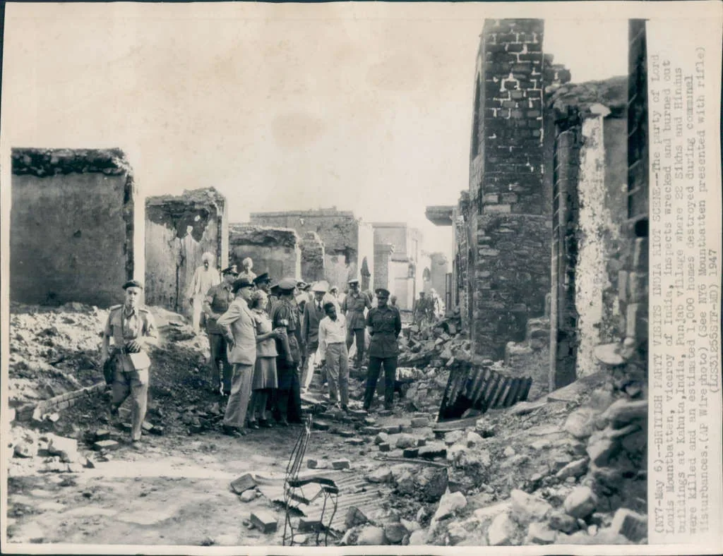
The new Viceroy, Lord Louis Mountbatten, arrived in early 1947 and decided the exit could not come soon enough. The original plan gave Britain until June 1948. Mountbatten tore it up and moved the date forward by nearly a year, to August 15, 1947. His reasoning was that the country was sliding toward civil war and that a fast, clean break would contain the damage. The opposite happened. Communal violence was already spreading from city to city, and the compressed timetable meant that the single most consequential decision, where exactly the border would run, had to be made in a matter of weeks by someone who had only just been handed the job.
The lawyer who had never seen India
Radcliffe was chosen precisely because he knew nothing about India. The idea was that ignorance would make him neutral, since he had no local loyalties and no stake in the outcome. He was given two boundary commissions to chair, one for Punjab in the west and one for Bengal in the east, each staffed by Indian and Muslim judges. Those judges deadlocked along the exact lines you would expect, so in practice Radcliffe drew both borders himself, alone, in the summer heat, with maps he did not fully trust and population figures that were years out of date.
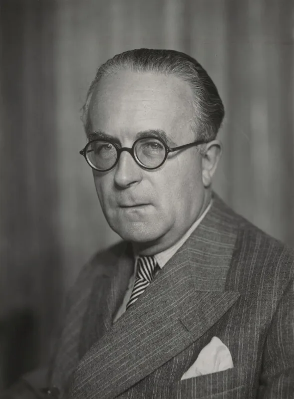
Unbiased at least he was when he arrived on his mission, Having never set eyes on the land he was called to partition.
That is how the poet W. H. Auden later described him. The lines held some 88 million people between them. Radcliffe finished around August 13. But the completed award was held back and not published until August 17, two days after the celebrations, so that independence would not be soured by the sight of the border. For those two days, millions of people danced in the streets of new nations without knowing which one their own house was in. Radcliffe left India on Independence Day itself, before his own boundaries were even announced. He destroyed his working papers so no one could reconstruct how he had decided, and he declined the fee he was owed. Asked about the job years later, he said he suspected both sides would remember him unkindly, and he was right.
The line that became a killing field
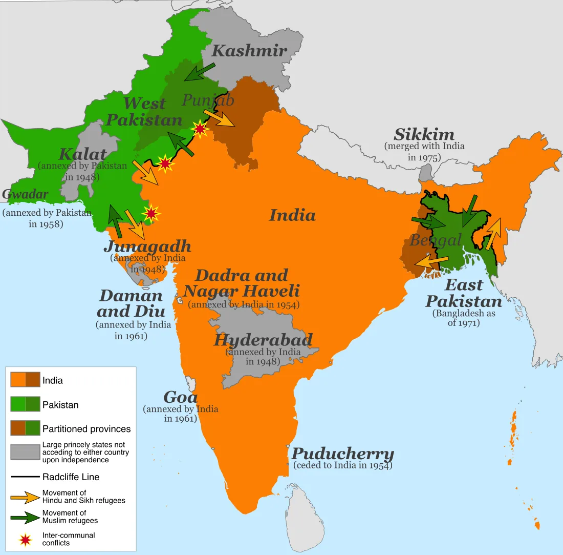
The award, when it finally appeared, split Punjab and Bengal down the middle, straight through farmland, canal networks, and towns where Hindus, Muslims, and Sikhs had lived side by side for generations. Suddenly people found themselves on the wrong side of a line they had not known was coming. What followed was not a tidy transfer of populations but a collapse into slaughter.
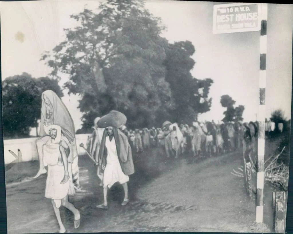
Roughly fifteen million people picked up what they could carry and moved: Muslims toward Pakistan, Hindus and Sikhs toward India. Many never arrived. In Punjab, armed bands hunted refugee columns and emptied entire villages. Trains were stopped and their passengers massacred, so that some pulled into stations carrying nothing but corpses. Women were abducted and killed in the tens of thousands. The Punjab Boundary Force, 50,000 soldiers meant to keep order across the whole divided province, was swept aside. Estimates of the dead run from 200,000 to two million; most historians settle somewhere past a million.
The comfortable assumption is that this was spontaneous madness, ancient hatreds boiling over the moment the British left. In reality much of it was organized. Political leaders on both sides had armed and mobilized militias, and the killing was as often targeted and planned as it was frenzied. The writer Saadat Hasan Manto caught the insanity of it in "Toba Tek Singh," a story about a man in a Lahore asylum who cannot understand which country his hometown now belongs to, and who finally dies in the no man's land between the two. That was the real question partition forced on people, and no one had given them time to answer it.
Why a five-week border still matters
Radcliffe's line only divided British India. It said nothing about the 560-odd princely states, the semi-independent kingdoms told to pick a side, and several of them refused to go quietly. The most dangerous was Kashmir, with a Muslim-majority population and a Hindu maharaja who hesitated until Pakistani tribesmen invaded, at which point he signed the state over to India as its army airlifted troops in. That unfinished choice became the deepest fault line partition left behind, and it has grown into a story of its own: the Kashmir conflict and the world's most dangerous border.
Kashmir was not the only kingdom brought in by force. Hyderabad, a large state in the south with a Muslim ruler and a Hindu majority, tried to stay independent until the Indian army marched in and absorbed it in a week in 1948. That same year the Khan of Kalat declared Balochistan independent, then signed it over to Pakistan, a move Baloch nationalists still call a forced annexation and still fight over today. Goa stayed a Portuguese colony until Indian troops seized it in 1961. And in 1971 the entire eastern wing of Pakistan, carved out of Bengal a thousand miles from the rest of the country, broke away in another bloodbath to become Bangladesh. The map partition drew took decades to stop moving.
The border itself has never stopped generating war. India and Pakistan have fought four times over what Radcliffe left them, in 1947, 1965, 1971, and 1999. Both later built nuclear weapons and now sit outside the treaty meant to contain them, two of only nine states on Earth with the bomb. In May 2025 they traded missile and drone strikes across the line, two countries with roughly 350 warheads between them, before an American-brokered ceasefire pulled them back.
Partition did not just draw a map. It wrote the operating system of South Asian politics. In India, Hindu nationalism still draws its energy from the memory of 1947, framing Muslims as a threat. In Pakistan, the founding logic that Hindus and Muslims are separate nations requires a permanent enemy next door. The border set the template for every rushed imperial exit that came after it, in Palestine, in Cyprus, across Africa: a departing power draws a line through people it does not understand, and leaves them to bleed along it.
That is the lesson buried in those five weeks. A line on a map is quick to draw and almost impossible to erase. Cyril Radcliffe drew this one in thirty-six days and never came back. Seventy-nine years later, two nuclear powers are still standing on it.
Test what you learned
5 quick questions on this article. No signup, just you against the text.