
Why Every Ancient Civilization Started on a River
Four rivers gave rise to four civilizations, but the Nile produced pharaohs, the Tigris produced warlords, and the Yellow River built a bureaucracy.
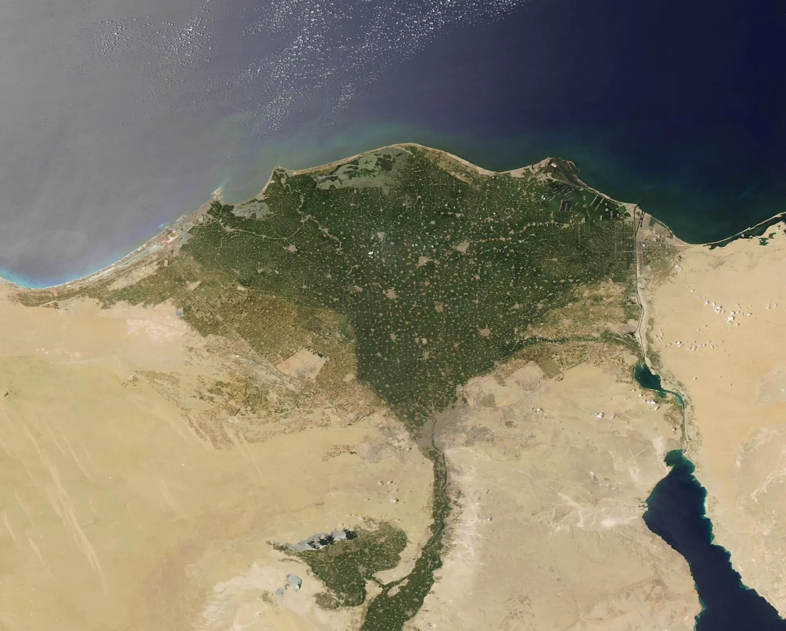
Around 3000 BC, the world had four major civilizations. One sat on the Nile in Egypt, one between the Tigris and the Euphrates in modern Iraq, one along the Indus in modern Pakistan, and one on the Yellow River in northern China. All four grew up in river valleys. No early civilization of comparable size developed anywhere else.
The usual explanation is simple: rivers meant water, fertile soil, and the food surpluses that let people stop farming and start building cities. That is true, but it explains only why civilizations appeared where they did, not why they turned out so differently. The Nile built a centralized kingdom that lasted 3,000 years under a single ruler. The Tigris and the Euphrates produced dozens of city-states locked in permanent war. The Yellow River demanded a bureaucracy powerful enough to move millions of laborers. And the Indus Valley may not have needed rulers at all.
How rivers made cities possible
Before the river valleys, no permanent settlement had grown beyond a few hundred people. Rivers changed that in three ways. Annual flooding deposited silt across the floodplain, creating soil so fertile it could produce grain surpluses year after year without exhausting the land. The river itself served as a transport route, letting goods, soldiers, and messages move faster and cheaper than overland, so a ruler in one city could govern territory hundreds of miles away. And farming along a narrow strip of floodplain packed people together at densities no scattered village could match. By 3100 BC, the Mesopotamian city of Uruk held between 40,000 and 80,000 people, probably the largest urban center on earth. But the character of each river mattered as much as its existence, and each character produced a different kind of state.
A predictable river and a violent one
The Nile flooded every summer on schedule, swelling from the Ethiopian monsoon rains and depositing rich black silt across the valley floor before retreating on time. The Egyptians built their calendar around this cycle: Akhet for the flood, Peret for the growing season, Shemu for the harvest. Because the flood was predictable, a pharaoh could calculate next year's grain yield, levy taxes in advance, and plan construction projects decades ahead. The Nile valley itself was rarely more than 12 miles wide, hemmed in by desert on both sides, and no one could invade Egypt's heartland without coming down the river or crossing the Sinai. Geography gave the pharaohs a natural fortress with a built-in food supply. The result was a centralized kingdom that endured, with interruptions, for roughly 3,000 years.
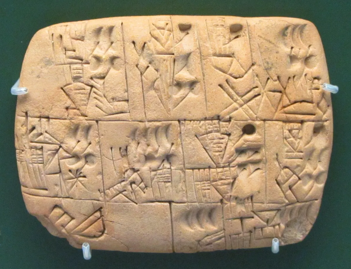
The Tigris and the Euphrates were a different kind of river. Their floods arrived without warning, sometimes destroying entire settlements. The water carried dissolved salts from the Turkish highlands, and centuries of irrigation slowly poisoned the soil. By 2000 BC, southern Mesopotamia's farmland had become so salty that wheat could no longer grow there, and farmers switched entirely to the hardier barley. Managing these rivers required irrigation canals, but no single authority controlled both rivers or the flat, open plain between them. Instead of one kingdom, Mesopotamia produced a patchwork of competing city-states: Ur, Uruk, Lagash, Umma. Around 2500 BC, Lagash and Umma fought a war specifically over irrigation rights, one of the oldest territorial conflicts on record. Writing itself likely emerged from this need to coordinate. The earliest cuneiform tablets found at Uruk, dating to around 3200 BC, are not literature. They are accounting records that tracked grain, livestock, and labor for canal maintenance.
The river the Chinese call their sorrow
The Yellow River drains the Loess Plateau in north-central China, and the plateau gives the river both its color and its destructive power. Loess is a fine yellow silt deposited by wind over millions of years, and the Yellow River carries more sediment than any other river on earth. That sediment settles on the riverbed, raising it above the surrounding land, until the river breaks its banks. Between 602 BC and 1949, the Yellow River burst through its levees roughly 1,600 times and shifted its course entirely on 26 occasions. A single flood in 1887 killed between 900,000 and 2 million people.
The civilization's founding story is itself a flood story. Yu the Great, the legendary founder of the Xia dynasty around 2070 BC, supposedly earned his throne by spending thirteen years directing laborers to dig channels and tame the river. He did not conquer a rival kingdom or win a battle. He completed a public works project. The pattern held for every major dynasty that followed. Controlling a river this destructive meant mobilizing tens of thousands of laborers to build levees, dig drainage channels, and relocate whole villages when the river shifted course. Only a strong central government could organize work at that scale. Qin Shi Huang, the first emperor to unify China in 221 BC, made river engineering one of his earliest priorities. The principle became explicit in Chinese political thought: a government that could not manage the floods lost the right to rule. The Chinese called this the Mandate of Heaven, and when the floods came, the mandate was the first thing people questioned.
The civilization that needed no king
The Indus River was gentler than all three. It flooded twice a year with the monsoon, reliably and without the violence of the Yellow River or the unpredictability of the Tigris. The silt it deposited created some of the most productive farmland in the ancient world. And the civilization that grew along it was unlike anything else.
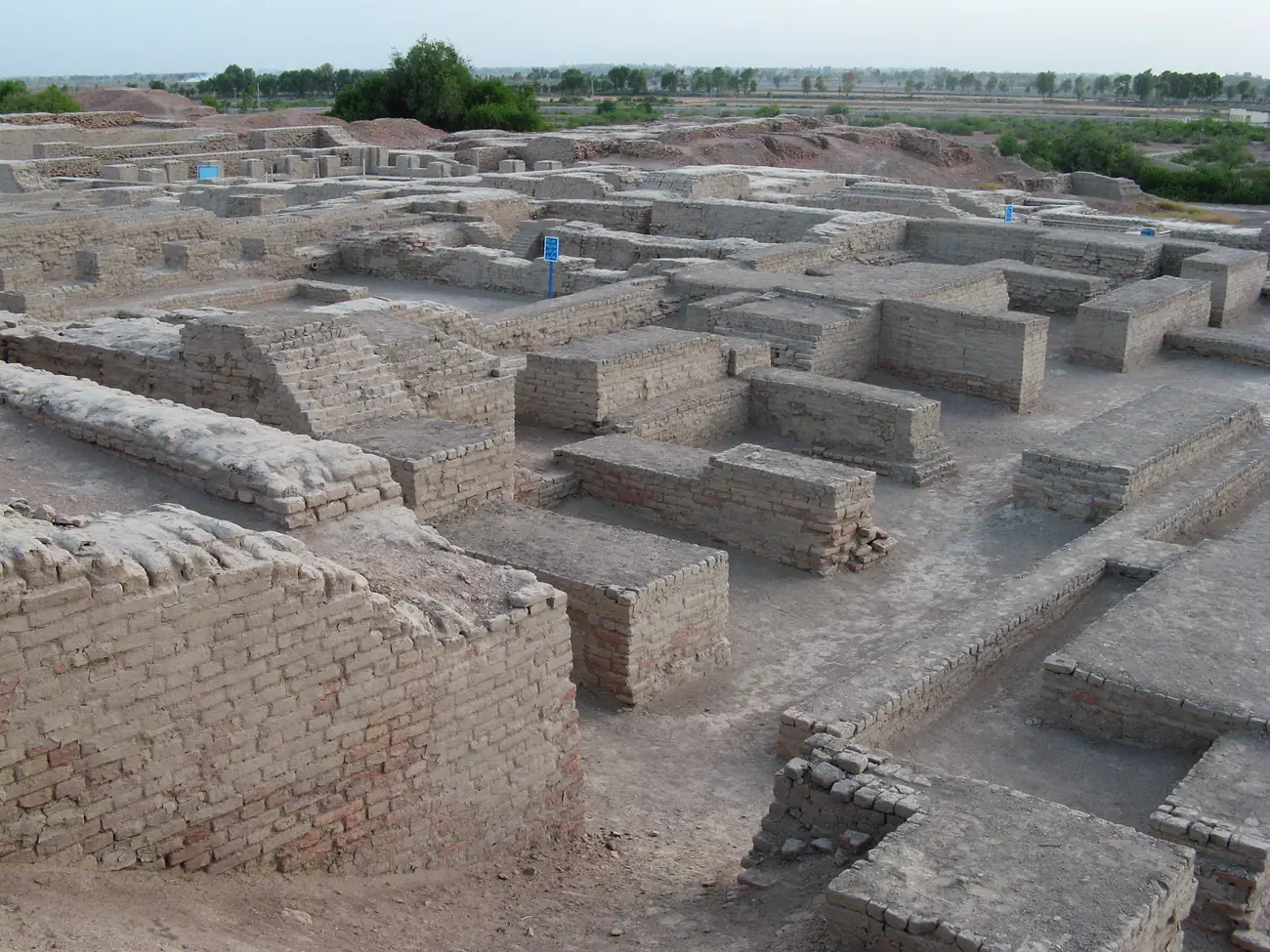
By 2600 BC, the cities of Harappa and Mohenjo-daro were laid out on precise grids, with streets running at right angles and houses built from standardized bricks in the same proportions across cities hundreds of miles apart. Every house had access to water. Covered drains ran along the main streets, connecting to the most advanced sewage system of the ancient world.
What the Indus did not build is more revealing than what it did. Archaeologists have found no palaces, no royal tombs, no monuments to conquering kings, and no evidence of a standing army. Wealth was spread more evenly than in any other early civilization: nearly every house had drainage and water access. The Indus Valley produced planned cities, long-distance trade with Mesopotamia, and standardized weights and measures, all without the kings, priests, or soldiers that every other early civilization treated as essential. Then, around 1900 BC, the monsoon weakened, the rivers shifted course, and the cities emptied. By 1700 BC Harappa and Mohenjo-daro stood abandoned. Nobody conquered the Indus Valley civilization. Its geography simply changed.
Why the same rivers still cause fights
The pattern those rivers set has not expired. Egypt still gets 97 percent of its freshwater from the Nile and treats Ethiopia's Grand Renaissance Dam on the Blue Nile as an existential threat. India and Pakistan share the Indus under a 1960 treaty that India has repeatedly threatened to revisit. China spends billions every year managing the Yellow River, whose channel now sits as high as 10 meters above the surrounding farmland in places, held in place by levees that would drown millions if they failed.
The first civilizations did not choose rivers by accident. A gentle, predictable river like the Nile let one ruler plan for decades and hold power for centuries. A catastrophic river like the Yellow River required a state powerful enough to conscript entire regions. And a cooperative river like the Indus may have made centralized power unnecessary, at least until the river moved. Geography did not just decide where people lived. It decided how they were governed.
Test what you learned
6 quick questions on this article. No signup, just you against the text.